

Land consumption mapping: Monitoring and control of the land and territory with satellite and aerial remote sensing technologies: output "Change quantification" and "Change attribution" Maps.
Land consumption mapping: Urban Landfills Monitoring and Mapping. A geo-information service based on Earth Observation technologies for rapid response mapping and long-term monitoring of sites affected by illegal spills.
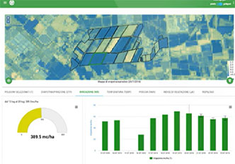
Automatic procedure to provide time series of several indices (NDVI, NDMI, STR, etc.) and Biophysical Parameters (Leaf Area Index, Fractional Cover, fAPAR) by using different satellite sensors (Sentinel-2, PlanetScope, Landsat, Deimos).
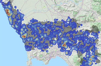
Using artificial intelligence tools applied to satellite images, SmartGO was able to highlight land consumption and scene changes. SmartGO products have been experimented and tested on the entire municipality of Naples.
Innovative solution based on the integration and customized processing of massive Open Data collections, including Earth Observation (EO) data, to monitor and support decision makers in the field of green areas management.
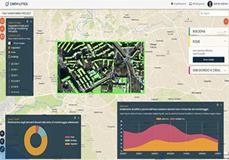
Multipurpose Ital-GovSatCom application Services for Emerging user Needs and Objectives (Service activated for Campania Region). Use EO data to produce (in NRT) Augmented Light Maps for Emergency management (by PANGEA Platform).
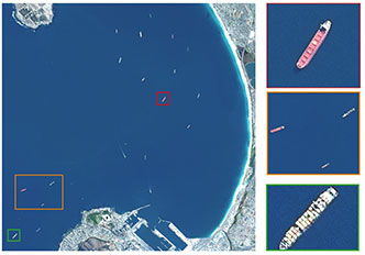
Coastal areas multifrequency SAR monitoring. The service has the purpose of monitoring maritime traffic in coastal areas through the synergistic use of SAR data taken from different satellites and operating in different bands.
Basic integrated platform running multiple EO applications such as COAST, SIMDEO (landfill detection and monitoring), Hyperfuel (dynamic fuel maps from hyperspectral) and CLEARUP (heavy metal pollution, from hyperspectral).
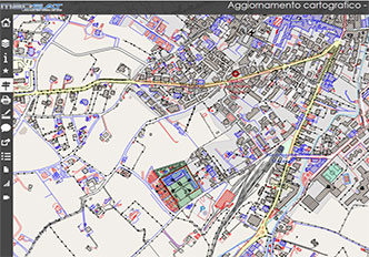
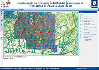
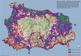
Service based on the analysis of medium-high resolution satellite images to identify urban expansion and analyze the dynamics of territorial transformation in relation to building activity and infrastructural changes.
If you are interested in the services of the AGLAIA suite, in this section you can insert your references to contact us and to receive more detailed information on our services based on the use of Earth Observation data.